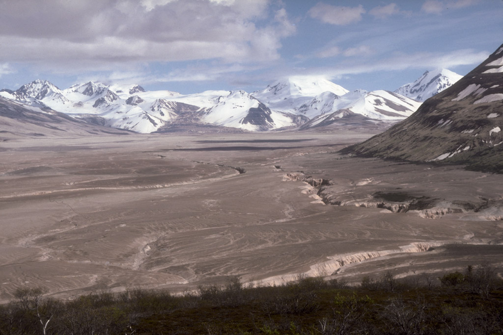
The next day (1st day of my 3 day weekend) I hiked to the Caldera and back - around 18 or 20 miles. The scenery is beyond description. A few miles from the shacks, what is left of Mt Katmai comes into view. There are 3 enormous glaciers that spill off of it and end in giant muddy feet, and across one of those feet and straight up the side of a snowwhite mountain you can see where the rim of the caldera would be. It is an incredible feeling to take a look at that landscape, see your destination 7 miles away and 3500 feet up, guarded from you by glaciers, snowfields, crevasses, and innumerable smaller hills and peaks, and then start walking that way alone. I had no idea when I started out if I would be able to do it but I decided to give it a shot. My buddy loaned me his cramp-ons and iceax, but I hardly needed them as the snowpack was still firm and good for walking. Coming over the last slope up to the rim, at 5500 feet above sea level, that first glimpse of the crater lake was breathtaking. A crystal bluegreen lake, massive, a few hundred feet below you. Like in a bowl with jagged mountain peaks for its rim. Thinking about it makes me regret, for the first time this summer, not having a camera. I tend to believe that my own memory offers a more true representations of the things I have done in my life than photographs, but in this case I wish I could send you some pictures. Here is one that that my friends Ralph and Greg took last year. The first shows part of the route up to the caldera. The snowy lip at the top is the rim. It was a much clearer day when I climbed it.

The second is a picture of the crater lake itself.

Here is an aerial view of the Caldera, which may be the best way to understand its scale.
The route that looked the easiest was to hike through a higher saddle between two peaks and then drop back onto the main glacier for the final push to the rim, and on that saddle before I dropped back down I got an added bonus. I could see the coast! Katmai Bay 20 miles to the south! Through my binoculars I could see the wide braided floodplain of Katmai River feeding out to the ocean, and waves lapping in on the shore. And in the distance, what I thought at first were distant clouds, was actually a range of jagged mountains - Kodiak Island, over 120 miles away. Imagine my feeling - I had always wanted to climb somewhere to see the coast, and I had no idea that this trip would put me in view of it. On the way back, I climbed the small hill whose saddle I was walking through and from there, I could see in a panoramic view the Pacific coast and Kodiak on one side and all the way 45 miles back to Brooks Lake and Naknek Lake (where I sit now typing this journal) on the other. Here is a good satellite image of the Valley, you can see my route - I started at the west end of Windy Creek, camped at Baked Mountain, then went to the Caldera and back. You can also see the Pacific Coast and Katmai Bay that I caught a glimpse of. It was a 12 hour hike that day, and when I finally made it back to Baked Mountain even a foam pad on a plywood bunk gave me pleasant dreams.